
Walk 13 - The Dingle
A delightful walk west of the hills starting in West Malvern descending through the countryside to the pretty village of Colwall. A fairly physically demanding uphill return is required, but fortunately ample opportunity is available along the route to replenish spent calories and to invigorate the mind and body.
The walk starts by heading up The Dingle - signs of quarrying are evident and further ahead is a strange looking weather vane, which is in fact an old sewer ventilation pipe (another three of these can be seen around West Malvern). After a visit to a hidden spring the route heads down Brockhill Road and past a pair of large lime kilns. Continuing past The Downs school, many folk are unaware they are passing over a miniature railway tunnel. The railway with a 9 ½ inch track extends for nearly a mile around the school grounds and is reputed to be the oldest private miniature railway in the world. Skirting around Colwall brings us to The Chase Inn before heading back towards West Malvern, past a five-storey former brewery which was active until the 1940s and is now apartments. A walk through the former West of England quarries brings us back to our starting point.
The Dingle, West Malvern to Colwall circular walk:
A delightful walk west of the hills starting in West Malvern descending through the countryside to the pretty village of Colwall. A fairly physically demanding uphill return is required, but fortunately ample opportunity is available along the route to replenish spent calories in which to invigorate the mind and body.
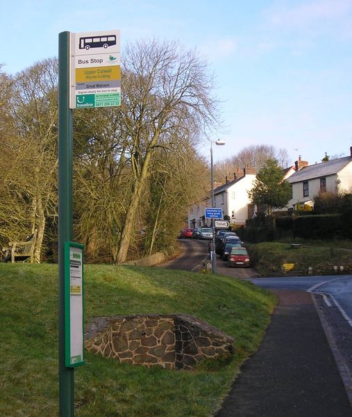
West Malvern clings to the side of the western slopes of the Malvern Hills. Sadly it is not blessed with wide thoroughfares and for us locals, it is often best to travel through Great Malvern and up the Wyche cutting than attempt to traverse the tiny roads half blocked by parked cars and most definitely avoiding the school children rush hours between 9am and 3pm. However outside of these busy periods it is possible to park near the Dingle, just a stones throw from the conveniently located Brewers Arms. The parking area is located next to the bus stop on the West Malvern Road on a large sweeping bend with enough room for 15 vehicles if parked carefully. Map Reference SO 76418 45675. Turn north as if heading back into West Malvern and the entrance to the Dingle should be on the right.
The Dingle is marked by a signpost on the side of the road and is accessed via a steep single lane road which starts off like many single tracks in the Malverns as a tarmac surface giving way to gravel later on. Signs of quarrying are evident on the left. Passing a cottage to the right and on the left one of the Malverns famous gas lamps, ahead is a strange looking weather vane. It is in fact an old sewer ventilation pipe, but as can be seen it has been decoratively redesigned into a weather vane. Another three of these can be seen around West Malvern.
Walking past the last of the cottages our first quest is to locate the tiny Dingle Spring. The track now peters out to a footpath and to the right is the bijou valley of the Dingle. Look out for a tiny unmarked path across the valley to the opposite bank and follow the path until it climbs uphill for a few metres and more or less hidden from general view in the side of the bank is this tiny spring. It has two concrete basins where a small pool of water can be observed. In the height of summer the spring can be dry and probably unnoticed except by the most tenacious of water searchers at map reference SO 76739 45612.
After enjoying the sight of the first spring on this walk head up the steep Dingle valley and about 100 metres from the top of the valley is a path on the right. Signs of Mountain Bike tyre tracks and horses hooves pursue this narrow path, so ensure young children are in check to avoid any collisions. Sometimes there are signs of temporary fencing for cattle grazing.
The path traverses around the hill bearing south losing a little height and then splits into two. The higher track goes past a wooden seat dedicated to a Mrs Percival who spent many happy hours on the hills with her children and dogs and onto Hillside Cottage which forms the penultimate leg of the return journey. Our expedition is however downhill traversing the footpath towards the West Malvern Road. On reaching the road turn right and cross-over to the unmaintained Brockhill Road by the West Malvern sign at map reference SO 76455 45296. Now head down Brockhill Road and a little further on to the left is a footpath sign which winds its way back up to the Hayslad Spout. Further down note the two rather grand stone turret shaped gate posts.
During April and May the banks of the road are adorned with the fragrant Wild Garlic which when in flower is well worth picking. It cooks just as spinach does wilting and reducing when steamed or gently boiled and makes a delightful addition to many dishes with its mild garlic aroma and spinach like consistency.
Continue down the uneven Brockhill Road and the entrance to Park Wood comes into view on the left. It is an ancient woodland mainly of oak owned by the Conservators at map reference SO76187 44373 and just beyond the entrance fairly intact are two lime kilns circa 1920’s, a bygone relic from the days of excavating lime to make quicklime which was used in the production of mortar. The water supply for the process probably came from the small spring emanating from the hill behind known as the Limekiln Spring. It is hidden from view and located further up the hill. For a quick detour pass through the stile of the Worcestershire Way and walk a further 150 metres uphill to the tiny spring at map reference SO 76157 44492.
Returning to Brockhill Road and turning left continuing downhill is the entrance to the Purlieu at map reference SO 76181 44222. To the right is a signboard on ridge and vale landscapes and next to it a footpath which skirts the edge of Brockhill Coppice. The term Purlieu is of French extraction and is used to identify an area on an outlying place or district. John Manwood in the 1717 edition of the ‘Old Forest Law’, defined it as ‘a certain territory of ground adjoining unto the forest (which) was once forest-land and afterwards disafforested by the perambulations made for the severing of the new forests from the old’.
A sign ‘Horse Thieves Beware’ brings our thoughts back to the failings of mankind. Continue down the wide potted road towards Colwall.
Many folk are not aware that as the Downs School grounds come into view they are passing over a miniature railway tunnel at map reference SO 75916 43317. The railway was built in 1925 with a7 ¼ inch gauge track, it now has a 9 ½ inch track. The line extends for nearly a mile around the school grounds and is reputed to be the oldest private miniature railway in the world.
Continue towards the school buildings but look out for the footpath hidden by conifers on the left. This will provide a short-cut around the back of the school buildings to the B4218 Walwyn Road. If this is missed do not worry as the main path continues through the main entrance of the school and onto the Walwyn Road a little closer to the village of Colwall.
Passing through the kissing gate the footpath reaches the main road via a cattle grid at the entrance to the ‘Winnings’. Cross over the road and up to Broadwood Drive. Continue up the single track road passing over the second tunnel of the walk, this time the main railway line between Hereford and Worcester. As a newish group of houses are approached, the footpath sign to the right indicates a quick clamber over the stone wall. Ignoring the path which leads straight to the farm, turn left, following the stone wall uphill in the direction of the Malvern Hills. Go through the galvanised kissing gate and continue uphill. Overhead are electrical power cables with the footpath almost directly beneath, leading towards a line of large redwood trees. A small footpath sign indicates the route to the left. Further up the hillside is Glenwood House where the original Primeswell Spring is located. The path now approaches a large gate onto a single track road at map reference SO 76389 42632.
Continue for a short distance and to the right is a footpath sign pointing up the hill, to the left is a house surrounded by trees at map reference SO 76576 42672. The path is quite steep and can be quite muddy as the outflow from the Ballards Spring higher up close to the Chase Road provides a substantial flow close to the path.
On reaching the Chase Road turn left and continue past the Chase Inn. Once past and a few hundred metres further on reaching the steeply twisting Walwyn Road at map reference SO 76674 42866.
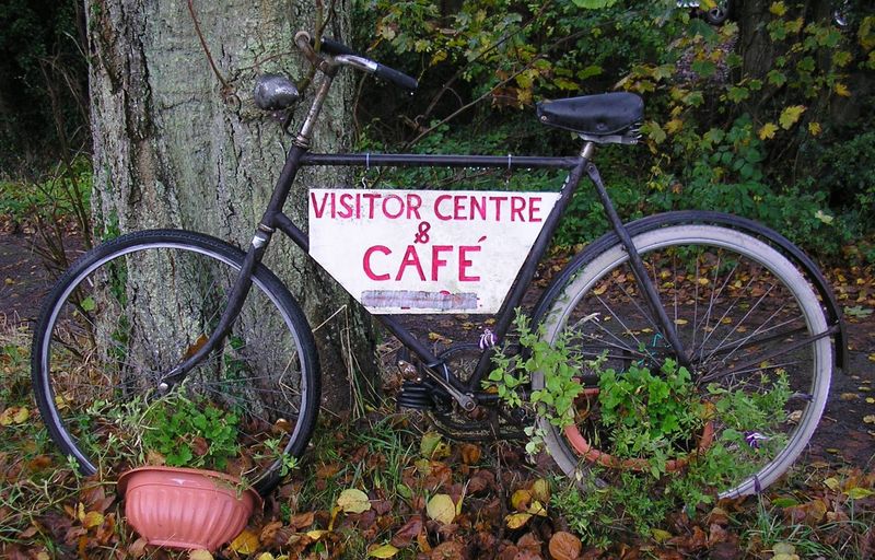
Crossing over the road there is a small driveway heading a short distance uphill parallel to the road and into the car park of the Malvern Hills Geo Centre Cafe which is located on the ground floor of the Wyche Innovation Centre. Map reference SO 76755 43467. This modern and inexpensive cafe has a computer database and projector screens describing the geology of the Malverns is open daily except for Wednesdays from 9.30 am to 4.30 pm. After enjoying a refreshment break continue uphill and past the tiny Wyche Spout to the junction of the West Malvern Road and the Beacon Road. Note the attractive cast iron bus stop on the right and behind it for those in need of public conveniences.
Head up the steep Beacon Road past the lower section of the car park. Although the OS map indicates a small single track road cutting through to the West Malvern Road to the left, this is not an option as it is a private driveway.
Reducing the length of one’s stride as the incline increases go past the ‘authorised vehicles’ only sign and about 50 metres further on to the left is a welcome footpath sign. The path heads down in a zig-zag fashion behind the gardens of Spa Cottage with the final section cut to steps and a useful hand rail for extra support. The narrow path emerges onto the West Malvern Road. Taking a right past the unusual looking five-storey building which was once the Royal Malvern Well Brewery soon brings you to the Royal Malvern Well at map reference SO76776 44214.
Its history dates back to circa 1869 when the Royal Well Mineral Water Company bottled the water from the Ryland Spring and made a range of products such as soda and seltzer waters, lemonade and also gingerade. Both the brewery and bottling works were in production until the 1940’s.
Continue along the path and some 20 metres past the Worcestershire county sign, the footpath heads up towards the trees and continues parallel to the road until reaching the West of England car park. This is a particularly large car park and it will take a few minutes to walk along its length. To the left the tanks above the Hayslad Spout are visible and often folk will be filling up containers with its particularly large flow of Malvern’s finest. Towards the end of the car park, head along the track signposted Hillside Cottage which is the middle one of three tracks. Continue past Hillside Cottage at map reference SO 76605 45162, and up to the junction of the path which now intersects with the outward bound section of the walk. Passing a wooden seat overlooking the Herefordshire Countryside with sadly some of its stays missing, a small plaque describes the many happy hours spent on the Hills by a Mrs M H Percival 1981, with her dogs and small children in tow. A slightly less strenuous way back is to head down and continue along the road, alternatively follow the path climbing back up towards the Dingle. Continue across the narrow valley of the Dingle past the spring and return downhill to the end of the walk on the West Malvern Road.
This is an abridged version of a walk from Book Four: A Pictorial Guide to the Malvern Hills, published by Malvern Walks at £7.95.
Available in local bookshops like the Malvern Book Co-operative (2 St Anne's Road, Malvern) and Tourist Information Centres in Malvern, Upton Upon Severn, Ledbury, Worcester.