
Walk 4 - A Magical Tour on the Malverns
Hollybush to White Leafed Oak and Raggedstone Hill circular walk
This is a short but fairly strenuous walk of just over two miles through the woods and meadows of the Eastnor Estate to the mystical White Leafed Oak Tree. After visiting the pretty hamlet of White Leafed Oak there is a steep climb to the summit of Raggedstone Hill.
The route is not suitable for pushchairs or cycles. Some of the paths are quite narrow and very steep in places. Note for those with dogs, sheep are to found in the fields approaching the White Leafed Oak tree. The summit of Raggedstone Hill is 254 metres.
It is best to start the walk from the Hollybush car park located on the brow of the hill at the junction of the county boundaries of Herefordshire and Worcestershire on the A438 Ledbury to Tewkesbury Road, map reference SO 7589 3689.
Take extra caution when driving in or around Castlemorton and Hollybush Commons, any of the roads can be made temporarily impassable by large herds of cows or sheep.
After reading the informative local Information Board in the car park, head down the Herefordshire side of the hill from the car park and past the bus stop and shelter for the 388 and 671 bus services. After 70 metres down the hill there is a ‘kissing’ gate to the left marked ‘Eastnor Castle Estate. Ragged Stone Common Wildlife Habitat’. Pass through the gate and under the canopy of the trees there are two paths, take the one to the right. The path to the left is for the return journey.
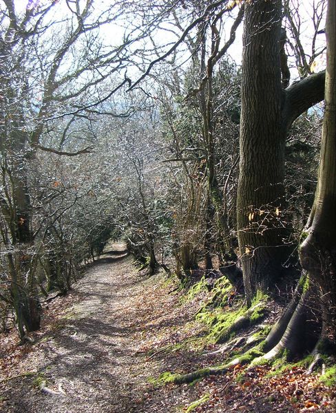
The path climbs steadily through the woods, the Eastnor Road is now down below to the right, with the hill rising to the left. There is a carpet of bluebells during the spring and plenty of blackberries along this route in August and September. The path can be overgrown up to head height with bracken and stingers in the Autumn, so if wearing shorts beware! Further on the path can be quite gloomy on a late evening due to the tree coverage.
The route to the infamous oak tree is accessed from the path when reaching the metal water trough at map reference SO 7576 3642. Now head downhill through a small clearing in the woods, to a five-barred gate, with its green footpath sign. Once through the gate, continue downhill keeping the wire fence to the next field to the right. There are great views of Chase End Hill with its white stone trig point to the south.
At the lower edge of the field amongst the trees and hedgerow there is a gap leading into the next field. Tractor tracks in the lush grass cross from left to right. Head right (north-west), following the main path between two large beech trees and the white fleece caught on branches where sheep have passed. Ahead are two oak trees, the older sinister looking tree is the one to head for as the footpath veers off to the left.
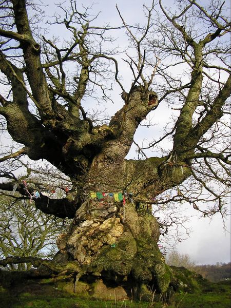
The White Leafed Oak stands on the edge of a hollow. It is adorned with all sorts of paraphernalia such as Tibetan Prayer Flags, glass beads and jewelry in the belief that this tree has symbolic meaning to Druids. The hamlet of White Leafed Oak is equidistant to the cathedrals of Worcester, Hereford and Gloucester. According to various websites other ancient Druid sites such as Stonehenge appear to be aligned in some magical manner to the White Leafed Oak! The supernatural influence of the White Leafed Oak has not gone unnoticed. Phil Rickman, a local author with his successful fictional female priest and exorcist Merrily Watkins has based plots around the White Leafed Oak and other sites in and around the Malverns for his novels. The map reference for the White Leafed Oak tree is SO 7550 3624.
Rather than returning uphill to the woods follow the path back to the tractor tracks and follow these keeping the hedgerow to the left to the five barred wooden gate into the tiny hamlet of White Leafed Oak. A notice board stands next to the lane and on it a leaflet of ‘harmony and the spirit of community the ancient power of stone circles’ thus giving a clue to the mystical background of this area. It is interesting to note that the three county boundaries of Herefordshire, Worcestershire and Gloucestershire meet in this tiny hamlet. The oldest surviving map of the Malvern Chase drawn in 1628 depicts the hamlet as ‘Cross Oke’.
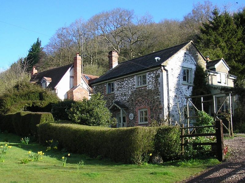
To the left 40 metres down the asphalt lane is a small triangle of overgrown stingers and brambles and set in the middle is a young white leafed oak planted by the Conservators, apparently replacing the original which was blown down in a gale. Keeping left, the return journey leads uphill through the gate with the cottage to the right. As the single lane track turns to the left there is a small path at a sharp incline to the left, signposted Raggedstone Hill. The path climbs up the steep hillside and then follows the ancient boundary of the Red Earl’s Dyke with a line of trees providing an attractive canopy to the left. The path inclines to 45 degrees and in keeping with its name over many loose stones before reaching a grassy summit at map reference SO 7594 3643.
Looking across the undulating Herefordshire and Gloucestershire countryside interspersed with the tiny needles of church spires, paints such a rich texture of colour that all is required is Elgar’s ‘Nimrod’ played through headphones to be brought to tears of joy.
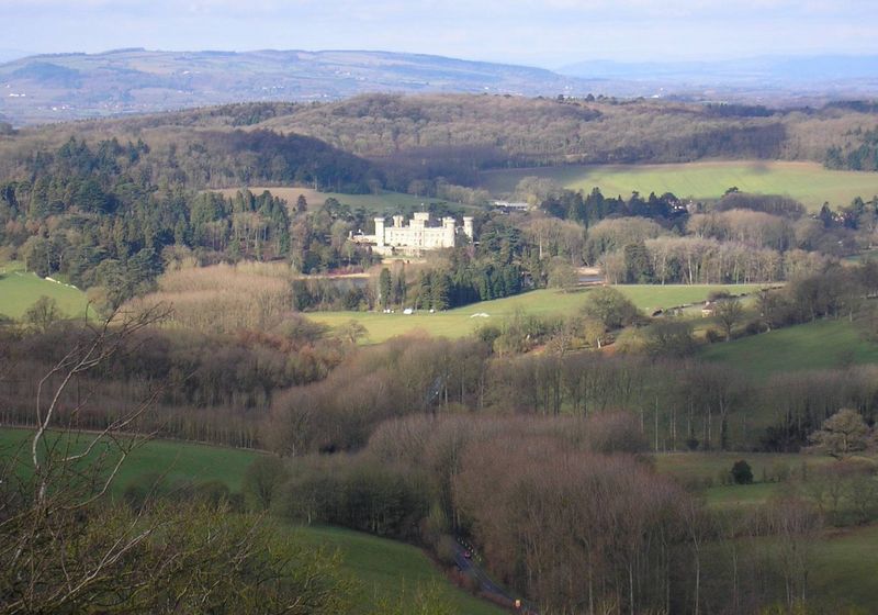
Continue across the summit in the direction of the Obelisk (north) and the clearly defined path soon heads downhill. The panorama of the Hollybush Quarry, Obelisk and path from Hollybush towards the Obelisk and Eastnor Castle are clearly visible. Only the car park is hidden by the trees. The path is very steep and slippery for much of its descent, but thankfully short. Before one realises, the road and kissing gate come back into view ending this magical mystery tour.
This is an abridged version of walk 12 from Book Three: the Pictorial Guide to the Malvern Hills. ISBN 9780956629517, published by Malvern Walks £8.50. Available in local bookshops like the Malvern Book Co-operative (2 St Anne's Road, Malvern) and Tourist Information Centres in Malvern, Upton Upon Severn, Ledbury, Worcester.
For further information, updates and comments, please contact Carl at info@malvernwalks.co.uk